Skip to content
Daniele Barbaro

Updated

Hiking for Freedom: My Journey into the Mountains

How do you clear away stress? How do you erase the negative moments and the anxieties that surround our lives? For me, the answer is simple: I walk, walk, and walk some more.

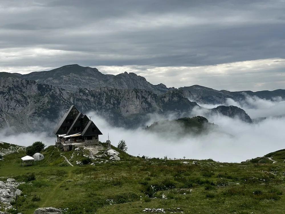
A stone mountain hut with a steep dark roof on a green shoulder, above a sea of clouds, gray limestone peaks behind

The long ones

Over the years, I’ve walked countless kilometers, completing the Cammino di Oropa, the Via degli Dei, and many loop hikes through the mountains of northwestern Italy.

In June 2025 I walked the Cammino dei Borghi Silenti, a four day loop that starts and ends in Tenaglie and passes through Melezzole, Collelungo and Civitella del Lago.

  1. Cammino di Oropa

    70 km, written down
  2. Via degli Dei

    133.6 km
  3. Cammino dei Borghi Silenti

    84.5 km
  4. An average day on the trail

    15 to 20 km

Lines drawn to the same scale, one tick every 10 km. The Via degli Dei and the Borghi Silenti come from my GPS tracks. The 70 km of the Cammino di Oropa are the distance I wrote down, because the track stops before the last climb to the sanctuary and measures 53.3 km. The last line is not measured either: it is the 15 to 20 km I wrote down for an average day.
Cammino di Oropa

to , from my GPS track

Map of my Cammino di Oropa GPS track: a 3 day route, with the end of each recorded track marked.
  • Start
  • End of a recorded track
  • Finish
Distance
70 kmGPS track incomplete: 53.3 km recorded
Days
3
Ascent
+1,310 m
Highest point
864 m
864 m191 m
0 kmElevation along the track, 191 to 864 m. Dashed lines mark the end of each recorded track.53.3 km
  1. Day 1,

    20.3 km, recorded as two tracks of 7.8 and 12.5 km

  2. Day 2,

    22.0 km, recorded as two tracks of 13.3 and 8.7 km

  3. Day 3,

    11.1 km

    The recording stops before the last climb to the sanctuary.

Via degli Dei

to , from my GPS track

Map of my Via degli Dei GPS track: a 6 day route, with the end of each recorded track marked.
  • Start
  • End of a recorded track
  • Finish
Distance
133.6 km
Days
6
Ascent
+3,630 m
Highest point
1,185 m
1,185 m67 m
0 kmElevation along the track, 67 to 1,185 m. Dashed lines mark the end of each recorded track.133.6 km
  1. Day 1,

    25.6 km

  2. Day 2,

    26.1 km

  3. Day 3,

    26.5 km

    The recording has a gap between this stage and the next.

  4. Day 4,

    22.5 km

  5. Day 5,

    16.9 km, recorded as two tracks of 12.1 and 4.8 km

  6. Day 6,

    16.0 km

Cammino dei Borghi Silenti

to , from my GPS track

Map of my Cammino dei Borghi Silenti GPS track: a 4 day loop, with the end of each recorded track marked. Named places: Tenaglie, Melezzole, Collelungo, Civitella del Lago.TenaglieMelezzoleCollelungoCivitella del Lago
  • Start and finish
  • End of a recorded track
Distance
84.5 km
Days
4
Ascent
+2,840 m
Highest point
972 m
972 m158 m
0 kmElevation along the track, 158 to 972 m. Dashed lines mark the end of each recorded track.84.5 km
  1. Day 1,

    Tenaglie to Melezzole24.0 km

  2. Day 2,

    Melezzole to Collelungo19.1 km

  3. Day 3,

    Collelungo to Civitella del Lago12.9 km

  4. Day 4,

    Civitella del Lago to Tenaglie28.5 km

Higher up

Some of my hikes are shorter and higher: a few days in the Alps, sleeping in a tent or a mountain hut, along the loops of northwestern Italy.

Giro del Monviso

to , from my GPS track

Map of my Giro del Monviso GPS track: a 4 day loop, with the end of each recorded track marked.
  • Start and finish
  • End of a recorded track
Distance
39.1 km
Days
4
Ascent
+2,560 m
Highest point
2,862 m
2,862 m1,654 m
0 kmElevation along the track, 1,654 to 2,862 m. Dashed lines mark the end of each recorded track.39.1 km
  1. Day 1,

    Castello to Bivacco Bertoglio7.0 km

  2. Day 2,

    Bertoglio to Rifugio Giacoletti, by Quintino Sella12.8 km

  3. Day 3,

    Giacoletti to Rifugio Du Viso, by the Buco di Viso8.2 km

  4. Day 4,

    Du Viso to Castello, by the Vallanta valley11.1 km

Mille Laghi, Valle d'Aosta

to , from my GPS track

Map of my Mille Laghi, Valle d'Aosta GPS track: a 3 day loop, with the end of each recorded track marked.
  • Start and finish
  • End of a recorded track
Distance
20.6 km
Days
3
Ascent
+1,570 m
Highest point
2,711 m
2,711 m1,885 m
0 kmElevation along the track, 1,885 to 2,711 m. Dashed lines mark the end of each recorded track.20.6 km
  1. Day 1,

    4.1 km

  2. Day 2,

    7.6 km

  3. Day 3,

    8.9 km

Marguareis

to , from my GPS track

Map of my Marguareis GPS track: a 3 day loop, with the end of each recorded track marked.
  • Start and finish
  • End of a recorded track
Distance
38.0 km
Days
3
Ascent
+1,740 m
Highest point
2,290 m
2,290 m1,027 m
0 kmElevation along the track, 1,027 to 2,290 m. Dashed lines mark the end of each recorded track.38.0 km
  1. Day 1,

    13.6 km, recorded as two tracks of 11.8 and 1.8 km

  2. Day 2,

    9.7 km, recorded as two tracks of 7.4 and 2.3 km

  3. Day 3,

    14.6 km

Usually three days

My hikes usually last no more than three days. I live a hectic life and often can’t take more than a few days off, so I aim for weekend adventures: either Friday through Sunday or Saturday through Monday.

Friday through Sunday

Saturday through Monday

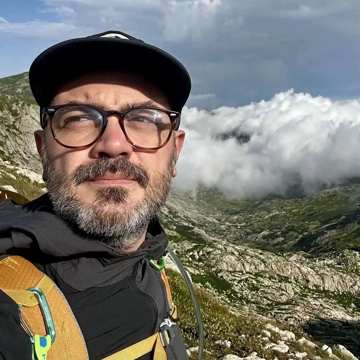
Close-up selfie of Daniele in a black cap and glasses, a bank of white clouds rolling over a rocky valley behind him
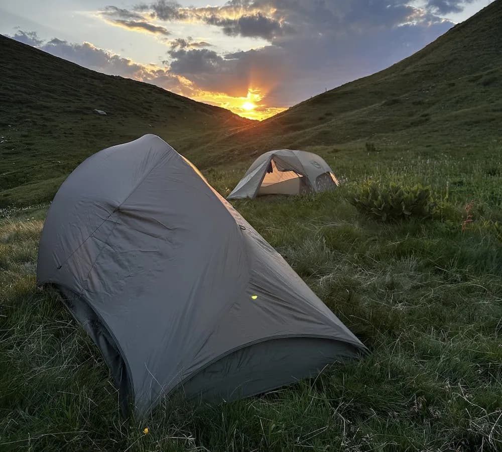
Two small gray tents pitched on a grassy slope between two hills, the sun setting in the gap between them

A tent, at forty

Just before I turned 40, my friends gave me a tent. In the summer of 2024 I spent my first nights camping out in nature, and I’ve been carrying it up the mountains ever since.

What can I say? It was spectacular. Sleeping under the stars, waking up surrounded by nature, cooking with camping gear, and walking among wildlife in the mountains: it was all incredible.

Hiking isn’t just about the journey or the distance; it’s about discovering your limits.

You need to be physically prepared to walk an average of 15 to 20 kilometers per day, but trust me, it’s worth it. There’s nothing quite like being immersed in nature at any time of day.

And that first sip of beer in a mountain hut or a bivouac? It tastes like freedom.

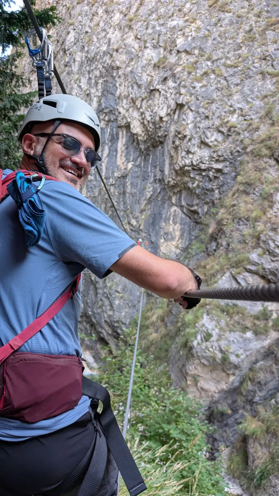
Daniele on a via ferrata in a white helmet and harness, one hand on the steel cable, turning to smile at the camera in front of a limestone wall

From the trail to the code

This passion for the mountains eventually led me to build TrekPass, a platform for outdoor associations and their members. When you combine a love for hiking with a love for code, things like this happen.

Walk with me

If you want to try this kind of trip, write to me: you will find how at the foot of this page. I’m always happy to swap stories and suggest a few of the trails I love in Piemonte.